| Location | Difficulty | Description |
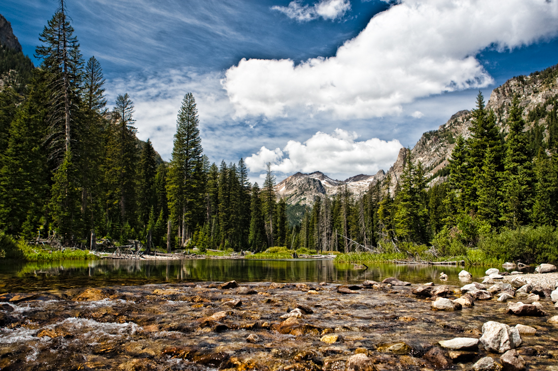
| South Fork Teton Canyon | Easy | The South
Fork of Teton Canyon is approached from the
Idaho side. This fork is very close to being
level ... it only gains 500 feet of elevation in
2.7 miles.
This is the first trail I usually hike with guests as it is very beautiful and is so easy. This gives them some time to become acclimated to the altitude while enjoying some great scenery. |
| Devil's Stairs | Difficult | This hike is
reached from the South Fork of Teton Canyon
trail at its 2.7 mile point.
This is a strenuous hike that gains 1,000 feet of elevation is less than a mile. Once at the top, you find yourself on a two mile long "shelf" that heads east and affords great views of the surrounding mountains. |
| North Fork Teton Canyon | Moderate | The North Fork of Teton Canyon is approached from the Idaho side. This fork is initially very steep and is the trail that eventually leads to Table Mountain. |
| Darby Canyon | Moderate |
Darby Canyon is reached from the Idaho side. One takes the
road one mile south of the Spud Drive-In back to the trailhead.
Darby is noted for the so called Wind Cave. This is a cave that goes back eight miles. In early summer there is a significant waterfall that cascades from the mouth of the cave. |
| Fred's Mountain / 9943 | Moderate |
Fred's Mountain is the ski mountain for Grand Targhee Ski Resort. It is
located about ten miles from Casa Budde West. One of the "hikes"; we take involves taking the
lift to the top of Fred's Mountain. Wonderful view from up there. Some snow even in mid-July.
For those who are a bit more adventurous, we hike off the mountain, up and over another pass and to a point that really has no name. It's elevation on the map is 9943 feet, so that's what we call it ... 9943. Spectacular view and not really too tough of a hike. We then hike back up to the top of Fred's and take the lift back down. |
| South Leigh Canyon | Easy | This is a nice fairly flat hike that circles the north side of Fred's
Mountain. It eventually heads to Beard's Wheatfield, the area behind Fred's Mountain. |
| Green Lakes | Difficult |
This hike is a fairly strenuous hike that goes almost to the summit of
Green Mountain and then on to some very beautiful lakes. This trail has become a favorite of the horse riding crowd and thus no longer a favorite of mine. |
| Table Mountain | Difficult |
This hike is the toughest
(4,000 feet of elevation gain in four miles) but
offers some of the most spectacular views you
will ever see anywhere. Table Mountain's summit is 11,103 feet and is right behind the Grand Teton (elevation 13,770 feet). One can view the Snake River valley to the east and Teton Valley to the west as well as the view looking north and south along the Teton Range. Here is a link to some more details. |
| Location | Difficulty | Description |
| String / Leigh Lake | Easy |
There is a hike we take
along String Lake and Leigh Lake that is very
flat and has spectacular views of the Tetons. The mountains jut up from the valley floor on the opposite side of the lakes. If the wind is minimal, there are some great reflections of the mountains on the lake surfaces. |
| Cascade Canyon | Moderate |
This trail
is the
first backpacking trip
I ever did in the park. It is still my favorite
hiking trail.
To get to the trailhead, one takes a ferry across Jenny Lake, hikes up to Hidden Falls, Inspiration Point and then into the canyon. |
| Taggart Lake | Easy |
The
trailhead is reached from the Park road.
You pass this lake on the way to Avalanche Canyon. You can also hike to Bradley Lake from this trailhead. |
| Avalanche Canyon | Moderate | The first time I hiked this trail was with Bruce & Betsy Canaga. That was the day we ran into the now infamous badger. |
| Death Canyon | Easy |
This hike is
reached from the White Grass Ranger Station
along the Moose-Wilson road.
The hike first goes to beautiful Phelps Lake and then climbs into Death Canyon. At the back of Death Canyon is Fox Creek Pass. |
| Surprise & Amphitheatre Lakes | Difficult |
This hike is
reached from the Lupine Meadows parking area.
It is a fairly strenuous hike that arrives at the two lakes. They are about 1 mile from each other. The effort affords one great close-up views of the Grand. |
| Paintbrush Divide | Difficult |
Paintbrush is the canyon just north of Cascade Canyon. If
you are backpacking, you can go over Paintbrush Divide (10,500 feet) and drop down into the
North Fork of Cascade Canyon to Lake Solitude.
Jim Scharff and I did that loop. |
| John D Rockefeller | Easy | This trail is reached along the Moose-Wilson Road. The hikes consist of several loops. One of the loops takes you to Phelps Lake. |
| Delta Lake | Difficult | Delta Lake is by far one the prettiest lakes in the Teton Mountains, and arguably the entire region. Fed entirely by Teton Glacier, the lake is a bold and brilliant turquoise that is tucked directly beneath the Grand Teton to the west, dominating one of the most dramatic and amazing scenes of a Teton peak. Be forewarned: Delta Lake is a very challenging trail that requires route-finding skills and a very steep ascent up a large boulder field. This trail is not at all for casual hikers. |
| Hedrick Pond Overlook | By car | Go north on Hwy 89 and just after the Teton Point Overlook there is a gravel road marked Lost Creek Ranch Road. Travel this road for 1.6 miles and turn left onto an unmarked dirt road. Travel this road for 1.1 miles and turn left on a lesser road. Go 0.5 miles and you will see a port-a-potty and some picnic tables. A great photo op is from the ridge with the small Hedrick Pond in the lower right of your view finder, the Snake River in the mid-ground and the Tetons in the background. |
| Location | Difficulty | Description |
| Ski Lake | Moderate |
This hike is
reached from a trailhead along Wyoming Highway
22 on the way to Jackson. It is on the east side
of Teton Pass.
Along this trail, you will see some very nice views of the Snake River valley to the east. Ski Lake itself is in a "bowl" up against a mountain. |
| Palisades Creek | Moderate |
Palisades
Creek is on the south side of the Palisades
range in Swan Valley just west of the Palisades
Lake dam.
It is a very pretty canyon and the hike will take you to a beautiful lake. We have seen many moose and a few eagles while having lunch overlooking the lake. |
| Coal Creek | Moderate |
This hike is
reached from a trailhead along Wyoming Highway
22 on the way to Jackson. It is on the west side
of Teton Pass.
At its highest point, it offers some nice views of the Teton Range as viewed from the southern end of the range. |
| South Horseshoe Creek | Easy |
This trail
is located on the west side of Teton Valley,
Idaho. It does not offer any views of the
Tetons.
It does however offer some great wildflower viewing in a forested setting. |
| Red Hills | Moderate | This area is east of Grand Teton National Park. The mountains are a beautiful shade of red and offer some nice views of the Tetons looking west. |
| Coyote Rock | Moderate | Located just east of Grand Teton National Park, high above the valley of Jackson Hole, lies a lone boulder secluded in its recession on a hill that delivers tremendous views of the region. This is Coyote Rock. Though the trail only brings you two miles from the road, the feeling of isolation and disconnection from the valley below is easily attainable. |
| Cascade Corner | Moderate | This area is in the
southwestern corner of Yellowstone and therefore does
not get nearly as much traffic as the main areas of
Yellowstone. I have only visited Cave Falls in this area but would love to visit some of these falls in the backcountry. |